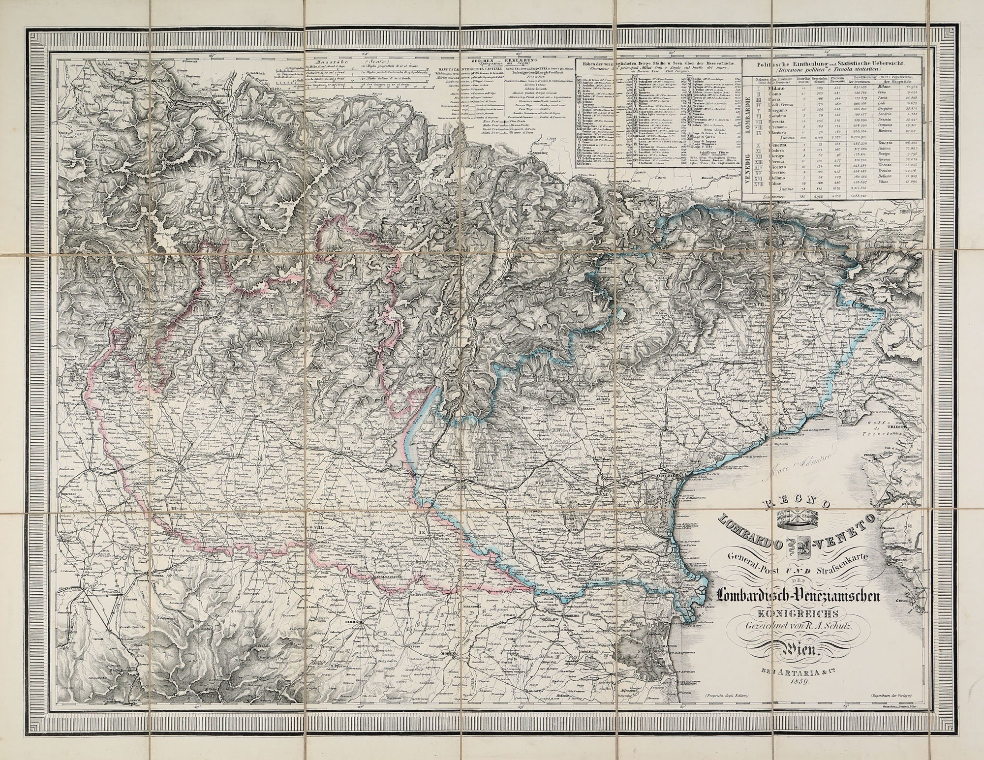
General-Post und strassenkarte des Lombardisch-Venezianischen Königreichs
Owner / Rights Management: Postamuzeum CC BY-NC-SA
Description
General-Post und strassenkarte des Lombardisch-Venezianischen Königreichs – A Lombard–Velencei Királyság általános posta- és úttérképe
Jobb felső sarokban táblázatok a városok tengerszint feletti magasságadataival, az ábrázolt terület politikai beosztásáról, területének és lakosságának adataival.
Rajzolta: R. A. Schultz
Metszette: Dominik Biller
Material / Technique
Dimensions
Papír / nyomtatott / mappában elhelyezve
teljes: 610x784 mm, térképrajz: 512x683 mm, mappa: 210x130 mm
Weboldalunk működtetése során a felhasználói élmény növeléséhez illetve a jobb kiszolgálás érdekében oldalunk “cookie”-kat használ. RészletekÉrtem
Privacy & Cookies Policy
Privacy Overview
This website uses cookies to improve your experience while you navigate through the website. Out of these cookies, the cookies that are categorized as necessary are stored on your browser as they are as essential for the working of basic functionalities of the website. We also use third-party cookies that help us analyze and understand how you use this website. These cookies will be stored in your browser only with your consent. You also have the option to opt-out of these cookies. But opting out of some of these cookies may have an effect on your browsing experience.
Necessary cookies are absolutely essential for the website to function properly. This category only includes cookies that ensures basic functionalities and security features of the website. These cookies do not store any personal information.